Visuals
The CRA at a glance
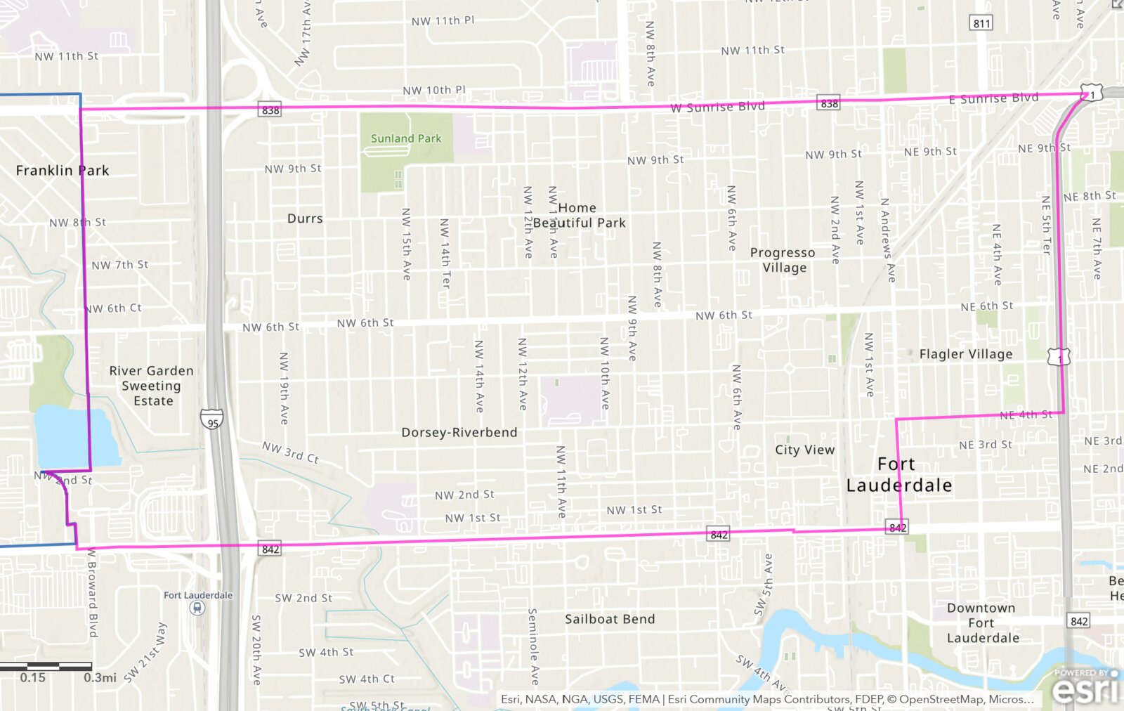
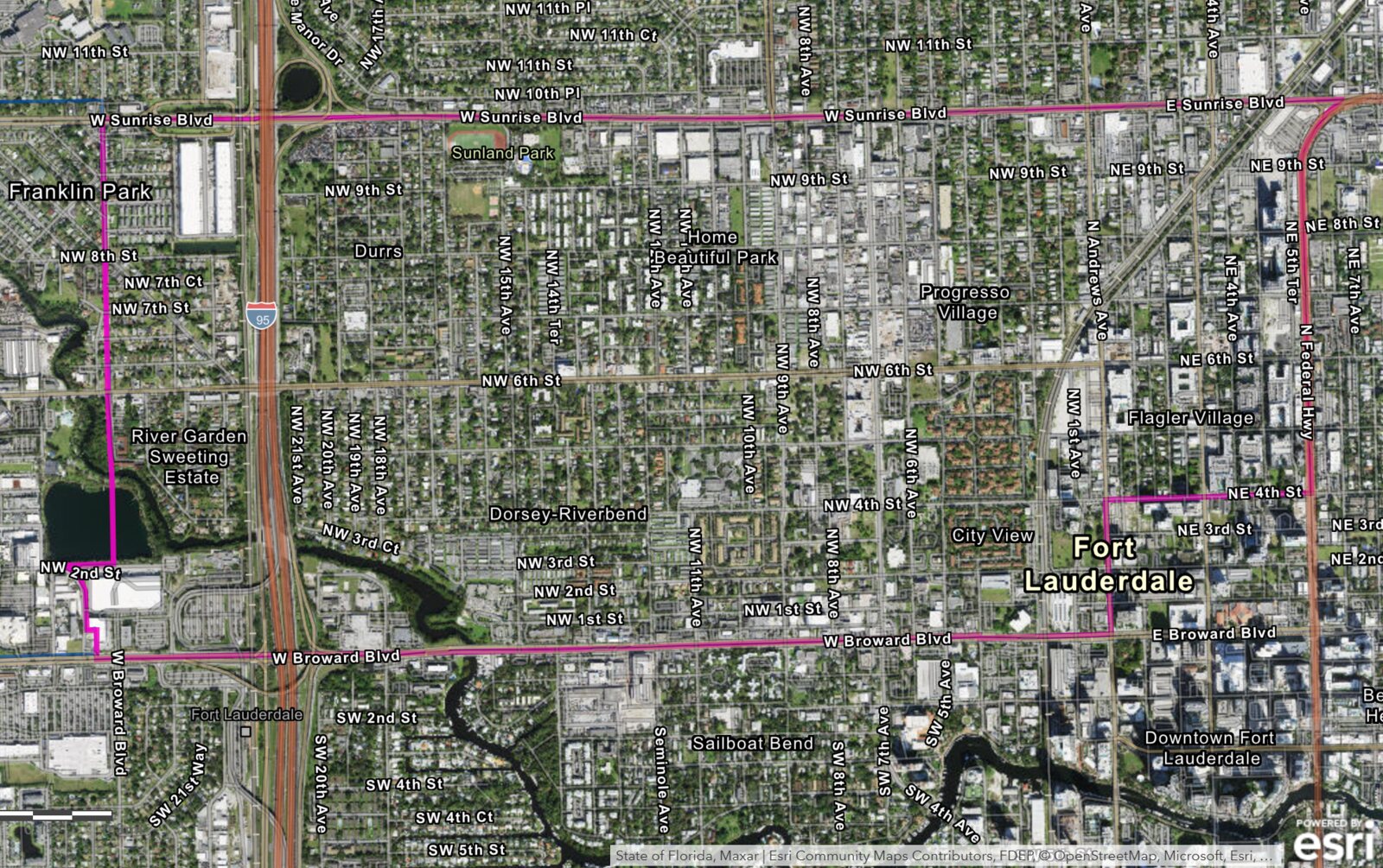
A district in transition: BusinessFlare® documented the existing conditions, proved continuing blight, and charted a plan update to extend the life of Fort Lauderdale's 1,412-acre Northwest-Progresso-Flagler Heights CRA.
The City of Fort Lauderdale engaged BusinessFlare® to prepare the analytical foundation for extending the life of its Northwest-Progresso-Flagler Heights (NPF) Community Redevelopment Area. Run concurrently, the work produced a comprehensive Existing Conditions & Assessment of Blight report, a Finding of Necessity for extension of life under Chapter 163, a P.I.E.C.E.-based public outreach process, and a data-driven CRA plan update.
The approach paired on-the-ground documentation with hard data — ESRI demographics and Tapestry segmentation, CoStar and MLS market analysis, CRA parcel and project inventories, crime statistics, and infrastructure records — organized against Florida's statutory blight criteria. The result frames a district that has grown and attracted investment on its eastern edge while its western and central core remains structurally constrained.
The conditions that created the CRA still exist. While the geography of progress has expanded — particularly near the Brightline station, Flagler Village, and FAT Village — the geography of need and blight remains entrenched across the core. The NPF CRA continues to meet the statutory threshold for a blighted area under Chapter 163.340(8), F.S., with at least 10 of 15 indicators still active — the legal and empirical foundation to extend the CRA's life and continue tax-increment redevelopment.
Existing conditions, finding of necessity, market and development analysis, and outreach — converging on a clear redevelopment direction.
The Existing Conditions & Assessment of Blight report (July 2025) profiled infrastructure, land, real estate, mobility, safety, culture, and resilience across the CRA's neighborhoods — Durrs/Dorsey-Riverbend, Home Beautiful Park, Progresso Village, City View, and Flagler Village — with Sistrunk Boulevard as the unifying spine.
The Finding of Necessity, prepared under Chapter 163.355 and evaluated against the 15 criteria of Section 163.340(8), F.S., combined multiple site visits and photographic documentation with government statistics. Florida requires only two criteria; the NPF CRA demonstrated at least ten remain active.
Analysis of ESRI, CoStar, and MLS data showed a dense consumer base leaking spending out of the district, alongside a development boom concentrated east of NW 9th Avenue. Projects like Motif Flagler, The Adderley, and The Gallery at FATVillage contrast with disinvestment west of NW 7th Avenue and I-95.
Outreach used BusinessFlare's signature P.I.E.C.E. framework — Preserve, Invest in, Enhance, Capitalize on, Expose — presented in English, Spanish, and Haitian Creole, with up to ten stakeholder meetings, a community open house, a resident survey, and coordination with Broward County.
The plan update translates the findings into coordinated action across economic development, residential and quality of life, public improvements and infrastructure, mobility and parking, and redevelopment support — pairing capital incentives with streamlined entitlements, backed by updated TIF estimates and five-year projections.